
Tag: spatial analysis
-
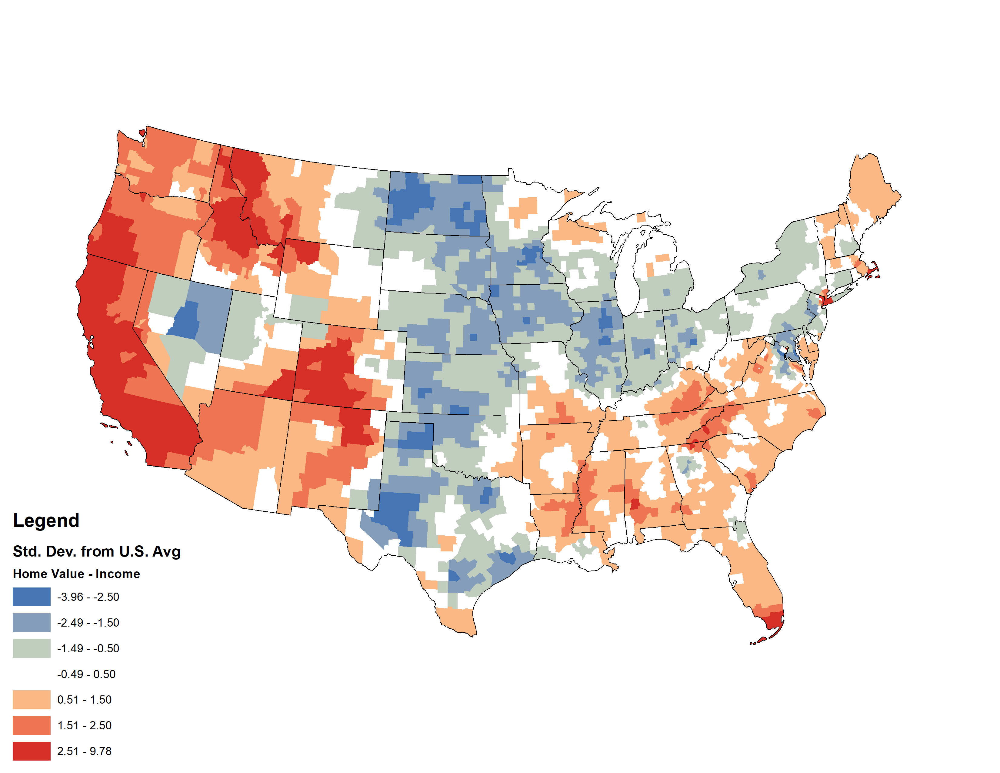
Comparing Median U.S. Home Values and Incomes
This week, my coworker showed me a cool map from Esri’s Living Atlas relating median home values with median incomes in the U.S. — click the image below to pull up the interactive map. I thought it was a cool idea, but something bothered me about the map. Later that night, I had a shower…
-
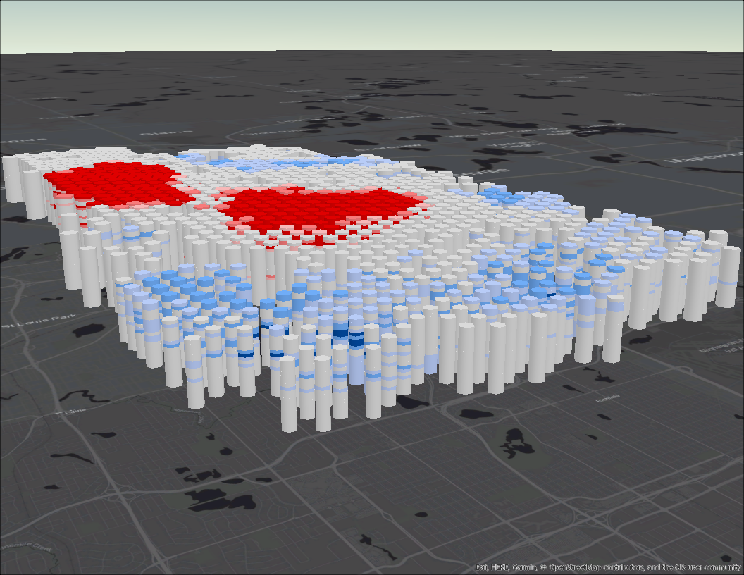
Analyzing Fires in Minneapolis Across Space and Time
After recently attending the Esri UC and listening to many sessions about spatial analysis, I have been inspired to test what I’ve learned. The City of Minneapolis where I currently live has an excellent open data portal, just waiting for GIS nerds like me to download and have some fun. Now I will walk you…
-
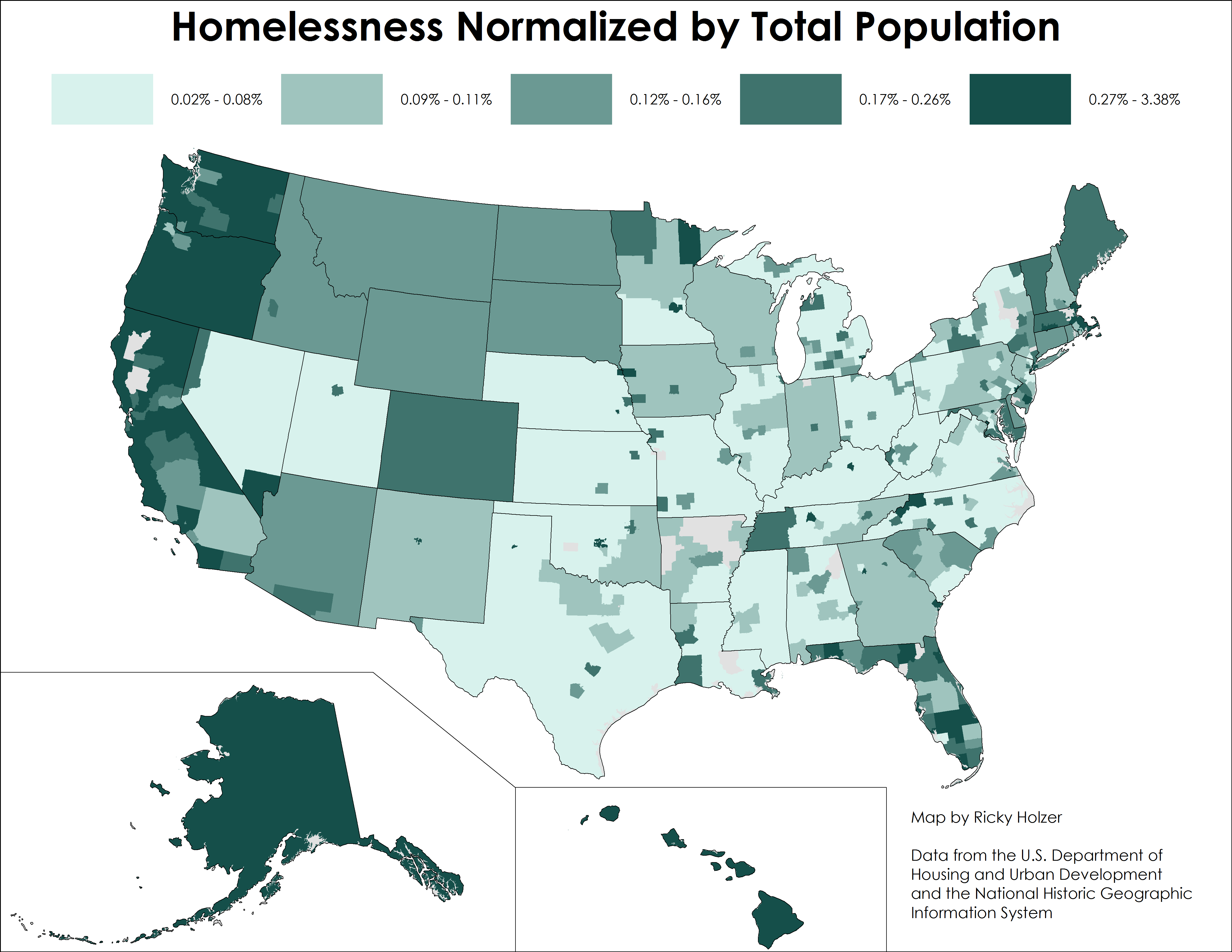
Mapping Homelessness in the United States
After reading an article about homelessness in the U.S., I read the comments at the bottom and saw the typical finger pointing claims that liberal cities like those in California are havens for the homeless because of their lax policies and plush benefits. In particular, Los Angeles is usually called out because of the notorious…