
Tag: cartography
-
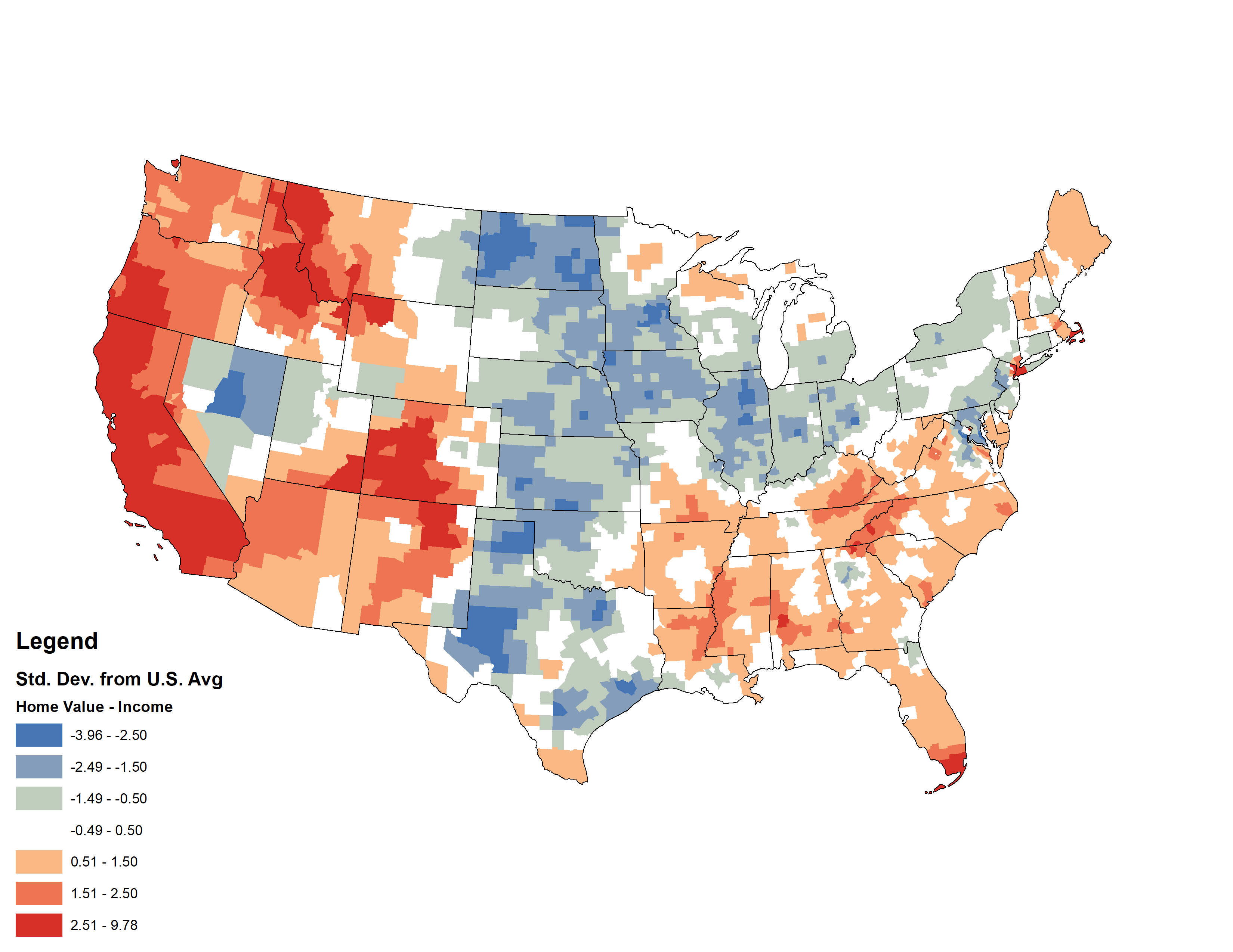
Comparing Median U.S. Home Values and Incomes
This week, my coworker showed me a cool map from Esri’s Living Atlas relating median home values with median incomes in the U.S. — click the image below to pull up the interactive map. I thought it was a cool idea, but something bothered me about the map. Later that night, I had a shower…
-
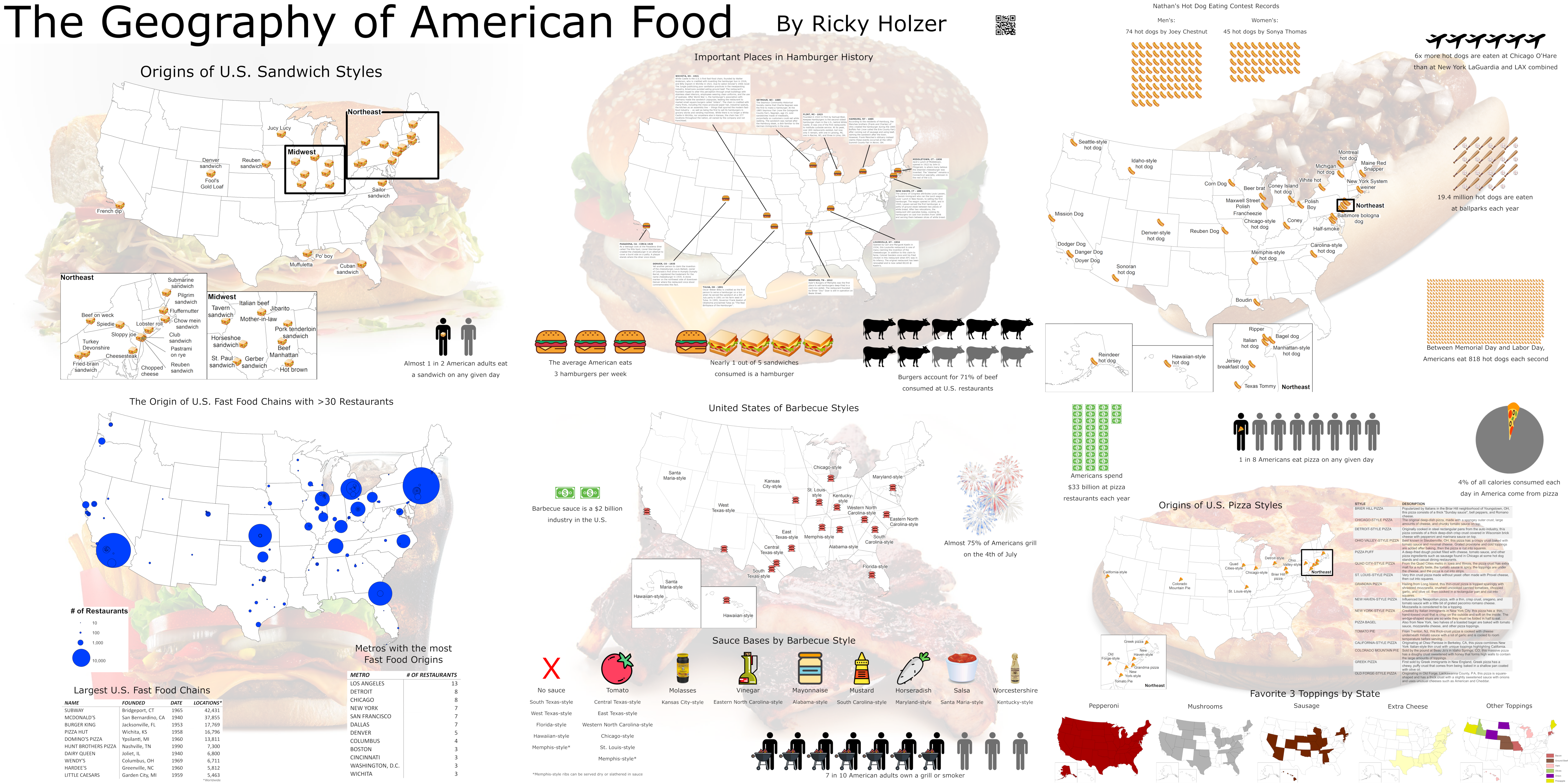
The Geography of American Food
I made this poster for the Minnesota GIS/LIS Consortium 2019 Conference. Stay tuned for posts diving deeper into barbecue, hamburgers, pizza, sandwiches, hot dogs, and fast food!
-
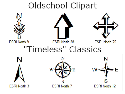
Adding Custom North Arrows to ArcMap 10.X
By far the easiest way to tell if someone used ArcMap to create their map is by looking at the north arrow. The first version of ArcMap, 8.0, was released at the end of 1999, and most of the software\’s included north arrows reflect the clipart-y style of that era. One of the simplest ways…
-
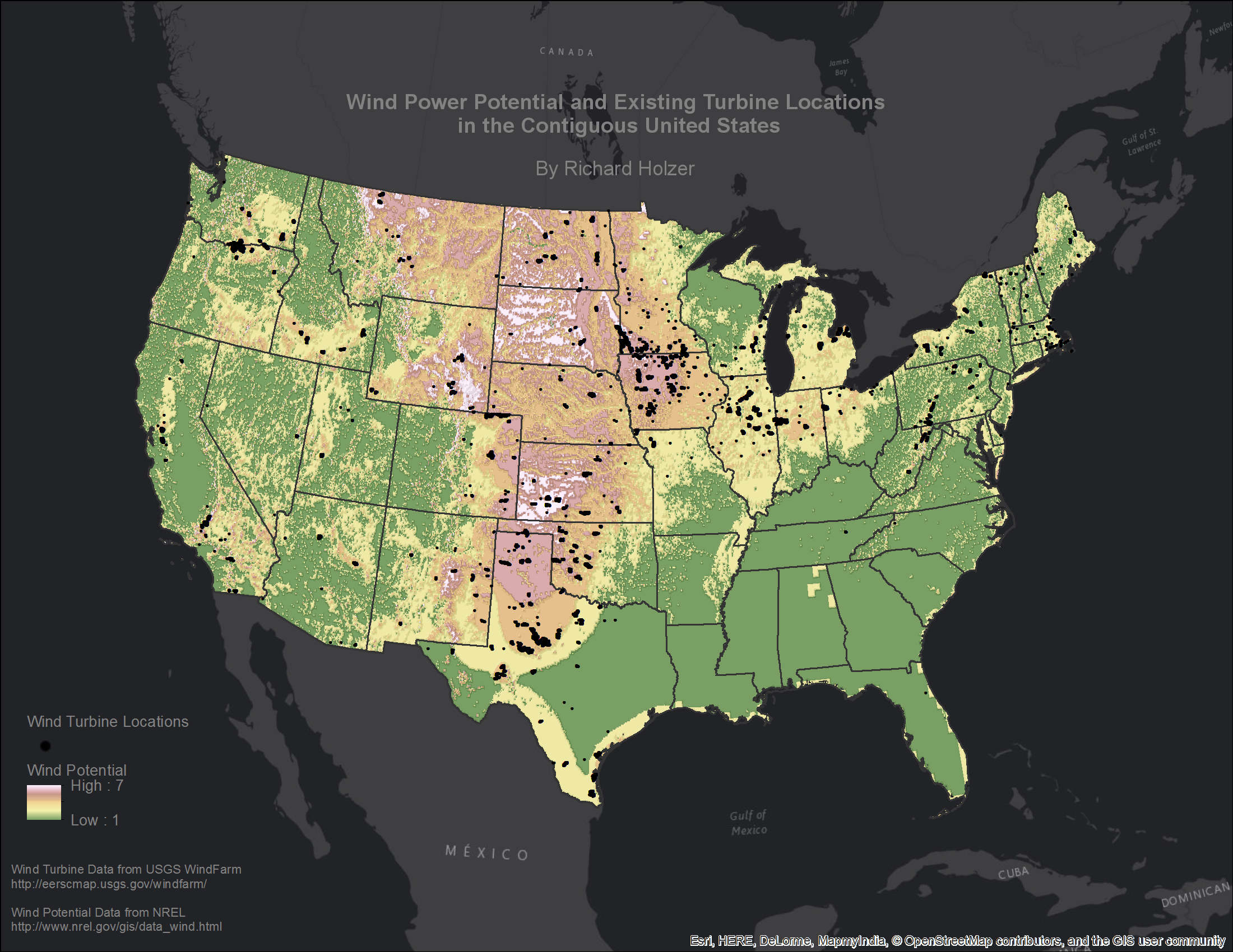
Mapping Wind Power in the US
I remember being amazed looking out the car windows at the wind farms in the Coachella Valley as a child, watching the otherworldly beauty of these giant structures spinning in unity during the day or the UFO-like field of blinking of red lights at night. I have been admiring the work of John Nelson since…