
Author: Ricky Holzer
-

This State is the Most Sinful
Unsurprisingly, Nevada is in the top 10 most sinful states, but it is not number one! That crown belongs to South Carolina. This analysis used popular brands as a proxy for each of the seven deadly sins: To assess the sinfulness of each state, I tabulated the number of locations for each brand using data…
-
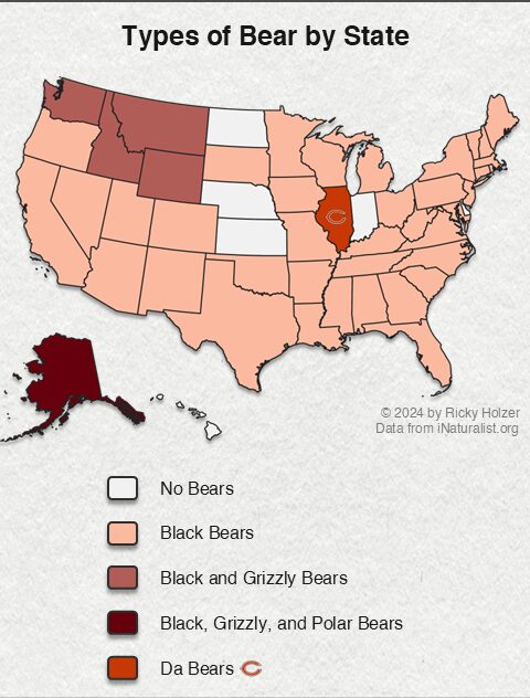
Grizzly, Black, Polar, and Chicago Bears in America
Alaska is the only state with three different types of bears. Grizzly bears only roam the Rocky Mountains and Pacific Northwest. Despite having grizzly bears on the state flag, they no longer live in California. Illinois doesn’t have any bears either, despite the name of their football team. View this post on Instagram A post…
-
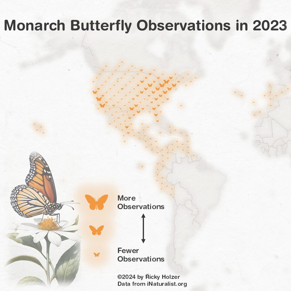
Where do Monarch Butterflies Live?
Using research grade observations logged on iNaturalist.org, this map shows where you can see monarch butterflies across the world. I was surprised to learn that monarchs live in Australia, New Zealand, and Spain in addition to the Americas. Related Maps
-
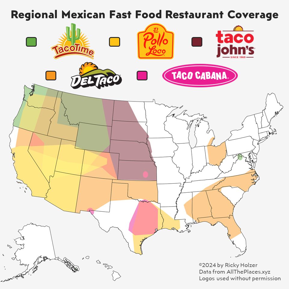
Beyond Taco Bell: Where Regional Mexican Chains Dominate
Unlike Taco Bell which serves all 50 states, smaller Mexican fast food chains operate on a regional basis. Del Taco covers the largest area, followed by Cheyenne, Wyoming based Taco John’s (which owned the trademark for “Taco Tuesday” from 1989 until 2023). Newcomer Taco Cabana mostly has restaurants in Texas. Taco Time has stayed true…
-
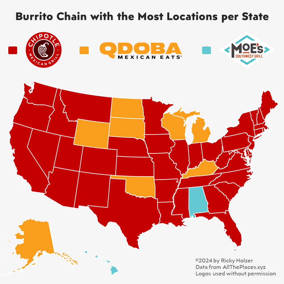
This Burrito Chain has the Most Restaurants
Chipotle dominates the United States, having more locations than any other fast casual burrito chain in 40 of 50 states. Moe’s Southwest Grill has the most locations in Alabama and Hawaii. Qdoba has more locations in 8 states: Alaska, Wyoming, North Dakota, South Dakota, Wisconsin, Oklahoma, Kentucky, and Michigan. Related Maps
-

This State has the Most Taco Bells
Despite having its roots in Southern California, Taco Bell has more restaurants per capita in the middle of the country. The Northeast has the lowest number of Taco Bells per capita. Perhaps the concentration of restaurants in America’s heartland is due to the lack of decent Mexican food? Related Maps
-
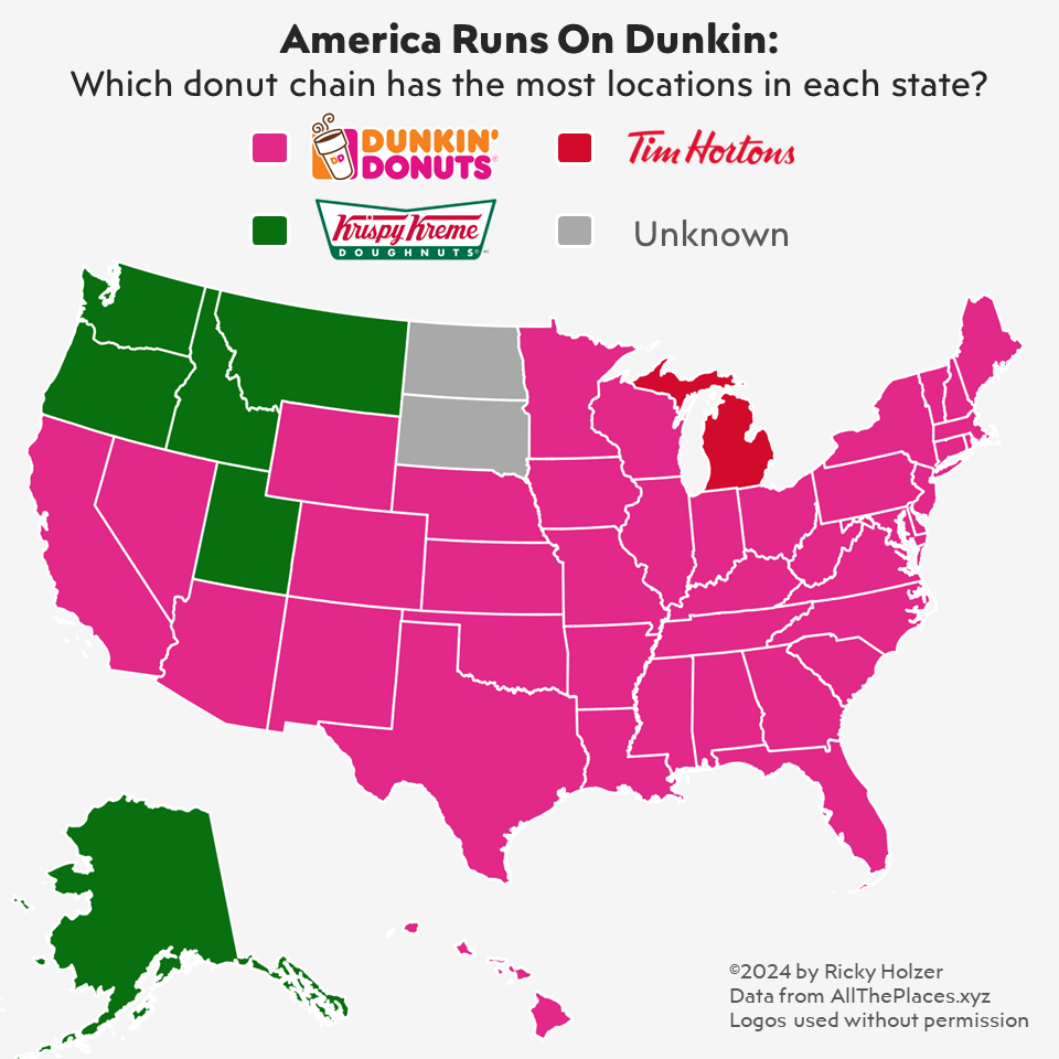
This Popular Donut Chain has the Most Locations
Turns out there is truth in advertising and America does in fact run on Dunkin. Dunkin Donuts dominates other donut chains and has more locations in nearly every state. Both New York and Massachusetts have over 1,000 Dunkin Donuts locations. Krispy Kreme is more popular on the west coast. Of the states with more Krispy…
-
7 Amazing Map Creators You Need to Check Out
With AI taking over the internet, it’s a struggle to find serious human creativity. Luckily, I’ve created this list to help you out in the map department. Some of these blogs I’ve followed for a long time, while some are recent discoveries. Whether you’re trying to improve your mapmaking skills or just enjoy looking at…
-
Mapping Washington State Representative Districts
Election season is upon us! And if you’re like me, you might be wondering what district you live in and what area your representative covers. I made a series of maps in QGIS to answer that question for Washington and Seattle residents. Check out the maps below: If you enjoyed these maps, follow me on…
-
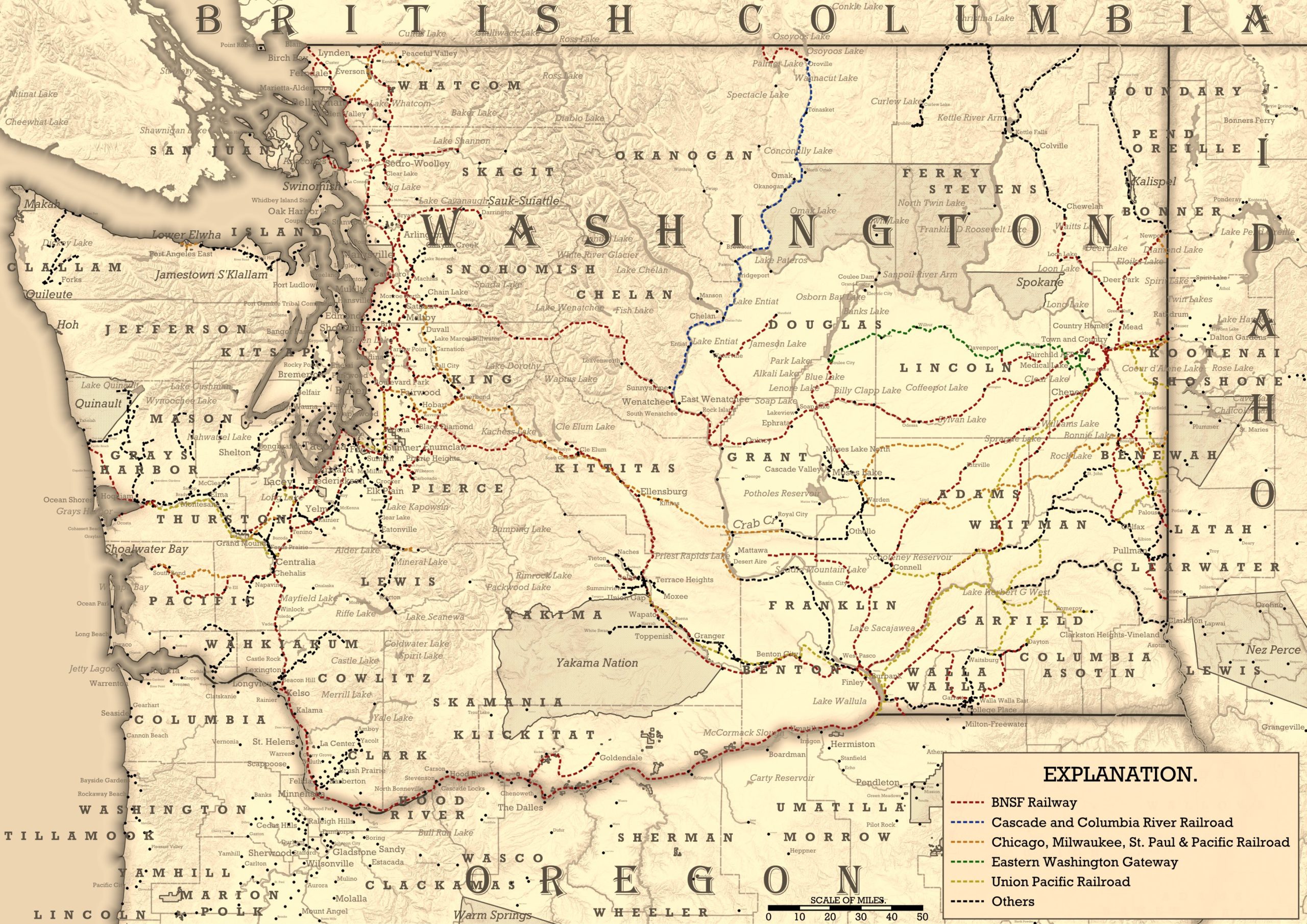
Recreating a Historic Railroad Map of Washington in QGIS
One bar I frequent has old maps under the glass tabletops in each of the booths. I’ve spent quite a lot of time staring at the map pictured below, and decided I wanted to try to recreate its old-timey style. Despite its beauty and charm, however, I do not think this is a well designed…